
Radar was indeed a technology that was missing on plotters as modular as the Nav-Station's N-series, but the wait was worth it!
The integration takes place via WiFi, so it will not be necessary to provide any particular wiring for the passage of data, but only need to mount the antenna, power it and connect it through a trivial procedure on the plotter itself.
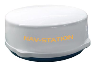
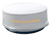
The radar antenna remains contained in 60 cm of diameter and releases 4 Kw to be able to go up to the range of 36 miles.
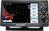
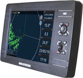
On the plotter we can be facilitated by a page dedicated to the radar settings, the tuning of the antenna and the choice of the desired display. The functions of the radar can be displayed in full screen, split (screen divided with other functions) or overlay (overlap) where the screen of the radar will appear superimposed on the cartography, where we can also get more details on the detected vessels, via AIS or DSC interface.
The screen can be oriented according to our navigational habits (to the north or in the direction of the bow or course), also with the echo stretch function we can magnify any targets to better distinguish them.
The antenna can be tuned automatically or manually. We can also insert anti-clutter filters to compensate for interference caused by bad sea or rain conditions.
The Radar-N36 antenna is already available in our warehouses and can be purchased from the best nautical retailers.