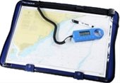
Through a Yeoman Plotter it will be possible to use nautical charts to electronically identify the position, determine the target position, trace routes and transfer them to a Nautical GPS or a radar.
It is a system that adapts to those who prefer to read the data on traditional paper and on this work for the correspondence. It can also be of considerable help if the on-board electronic equipment fails.
