GPS - Global Position System

GPS, Global Position System, is a satellite system developed by the US Department of Defense.

The NAVSTAR GPS System

GPS - Global Position System n.1

Commonly referred to as GPS, it also includes devices that use this system to give position, such as GPS navigators.

The GPS system project was developed back in 1973 under the name of NAVSTAR, but only in 1991 it began to be usable (at certain times and areas) and in 1994 it became fully operational.

Initially, the U.S. government imposed the SA (Selective Availability) filter so that civilian operators could not benefit from maximum accuracy, thus degrading the error from 25 mt. to 100 mt. In 2000 they removed the SA filter, but this filter remains at any time re-insertable at the discretion of the US government.

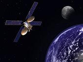
The GPS system uses polar satellites in a number between 24 and 32, which run certain orbits at low altitude around the earth, covering the entire globe.

Causes of Error and Correction Systems

Causes of Error

The following are the most common circumstances in which the GPS may be subject to a higher error:

  • Atmospheric delay: the signal from the satellites slows down as it passes through the atmosphere. The system is corrected with an average delay calculation, which therefore has an error tolerance.
  • Multiple routes: GPS signals can be reflected from high buildings or mountains before reaching the receiver. This slightly increases the arrival time.
  • Receiver clock: The time of the GPS receiver may not be perfectly synchronized with the atomic clock of the satellites.
  • Orbital Errors: Satellites may be slightly out of their assigned orbit.
  • Satellite geometry: the further apart the satellites are, the greater the accuracy of the measurements. GPS normally indicates this error with the abbreviations HDOP (horizontal error) and VDOP (altitude error).
  • Number of visible satellites: the more satellites are in view of the GPS receiver, the higher the positioning accuracy. Buildings, mountains, electromagnetic interference, can block the reception of the signal causing a positioning error or failure to position.

Correction Systems

Thanks to the use of correctors the GPS can improve its accuracy from 25 m up to about 5 m or in some cases even less.

The most used corrector is the WAAS/EGNOS, the WAAS (Wide Area Augmentation System) is US, while the EGNOS (European Geostationary Navigation Overlay Service) is the European version of the WAAS system. The EGNOS system is based on 3 geostationary satellites transmitting the correction data, a network of ground stations processing GPS signal delays and a series of central data processing stations.

Another corrector used only in certain areas is the DGPS (Differential GPS), which transmits the correction data via ground radio stations. DGPS is now less and less used with the advent of the WAAS/EGNOS system.

There are also local proofreaders, which transmit the proofreading data via GPRS/UMTS, or the DGPS-IP, which sends the proofreading data via the Internet.

The competitors of the GPS system

In the past, instruments such as the sextant (still useful in case of failure of on-board instruments), the radiogoniometer (still used in some systems to better locate the position of shipwrecked) and the loran (abandoned since many ground stations have now been decommissioned) have been used for localization.

Systems comparable to GPS, also called GNSS systems, are European Galileo and Russian Glonass.

Galileo is the most modern project and is expected to be operational from 2014. The accuracy with active corrector can reach 65 cm.

The GLONASS, on the other hand, suffered from the Russian financial crises and was operational at alternate times. Since December 2011, it has been operational again with 24 satellites and allows an accuracy of 55 m on the horizontal plane.

In the near future, it is planned to market equipment that can operate with more than one GNSS system (GPS/Galileo/GLONASS), thus ensuring greater reliability and accuracy.